Your gateway to digital farming.
Your gateway to digital farming.
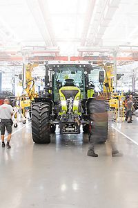
Smartly connected with CLAAS connect.
Smartly connected with CLAAS connect.


The Farm connect licence offers the following advantages:
The Farm connect licence offers the following advantages:
Simple task management.
Simple task management.
Simple task management.
Simple task management.
Share and allocate tasks online. Create, send, receive and document your fieldwork – via USB or online.
Get the complete picture with digital maps.
Get the complete picture with digital maps.
Get the complete picture with digital maps.
Get the complete picture with digital maps.
You can upload yield maps from different sources in ISO XML and Shape format in the Geocenter. The system interpolates these maps for you and displays them in CLAAS connect. So at last you have all your maps in one place – easy to find, easy to use.
Keep track of all your machines.
Keep track of all your machines.
Keep track of all your machines.
Keep track of all your machines.
Keep track of the position and status of your machines at all times – for optimum management. Using the app, you can direct your team to ensure that every driver navigates to the right place and can always see what's going on.
Managing master data.
Managing master data.
Managing master data.
Managing master data.
Manage resources, machines, colleagues, consumables and fields using the key parameters. Document your activities by field.
Track and document everything virtually.
Track and document everything virtually.
Track and document everything virtually.
Track and document everything virtually.
Always want to know when it's home time or time to move on to the next field? No problem: CLAAS connect calculates the time to completion for each job. So you can plan the deployment of machines and ressources down to the last detail.


The Fleet connect licence offers the following advantages:
The Fleet connect licence offers the following advantages:
Automatic field-based documentation.
Automatic field-based documentation.
Automatic field-based documentation.
Automatic field-based documentation.
All your machine activities are automatically documented and aggregated based on field boundaries – you don't need to do anything. The Fleet connect algorithms can even record several machines in the same field.
Postings are so straightforward.
Postings are so straightforward.
Postings are so straightforward.
Postings are so straightforward.
Fleet connect automatically displays the aggregate work as evaluation proposals – consigning annoying paperwork and endless typing to the past and leaving you time to focus on the important things.


The Field connect licence offers the following advantages:
The Field connect licence offers the following advantages:
Get more from your fields with satellite data.
Get more from your fields with satellite data.
Get more from your fields with satellite data.
Get more from your fields with satellite data.
Want to get more from your fields? You can use current and historical satellite data to display vegetation maps and create potential maps. This enables you to tailor treatments to specific areas.
Create maps with variable application rates.
Create maps with variable application rates.
Create maps with variable application rates.
Create maps with variable application rates.
With Field connect it's easy to create digital application maps for drilling, fertilising and spraying. You can use vegetation maps, potential maps, yield maps and other maps to help – and edit and export each application map individually. CLAAS connect: for targeted use of resources and maximum returns.
Plan your tracks virtually.
Plan your tracks virtually.
Plan your tracks virtually.
Plan your tracks virtually.
With Field connect, planning tracks in the field is simple and effective. For example, you can use the tool to create reference tracks based on field boundaries.
If you already used machine data from TELEMATICS or field data from AGROCOM Map, 365FarmNet or other systems, you can of course transfer this date to CLAAS connect.
If you already used machine data from TELEMATICS or field data from AGROCOM Map, 365FarmNet or other systems, you can of course transfer this date to CLAAS connect.